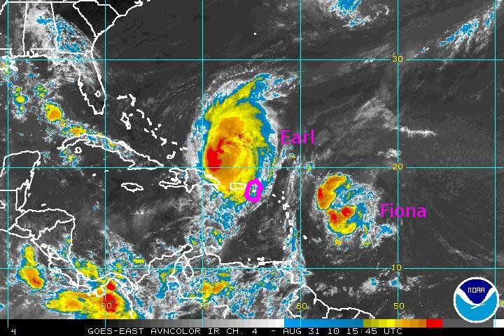
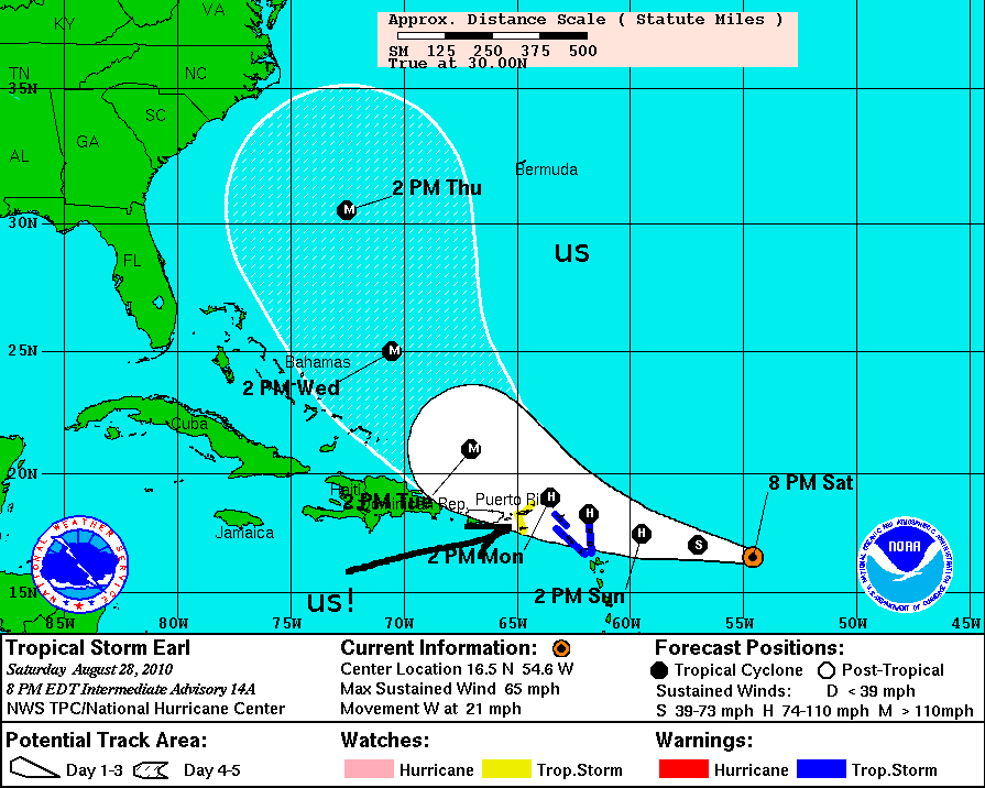
Hurricane Earl started as an African easterly wave, gradually intensifying as it moved westward across the Atlantic. This is a "Cape Verde" storm, as it formed not far from the Cape Verde Islands off the coast of Africa. Here it is approaching us in St. Croix. It is forecast to pass about 100 nm north of us as an intensifying Category 3 storm (max winds 100 kts). Below is the forecast "cone" from the National Hurricane Center as of 0000 UTC, 29 August.
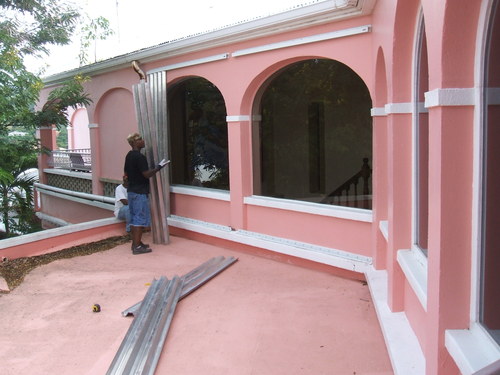
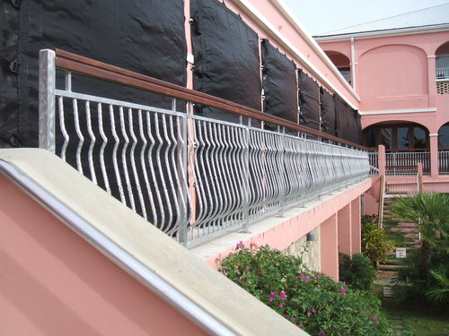
On the left below, Buccaneer Hotel staff put up storm shutters. On the right we see the "hurricane cloth" shielding the terrace where we eat breakfast. It is guaranteed to withstand the impact of a 2x4 moving at 250 mph! The Buccaneer generates its own electricity and has its own water supply.
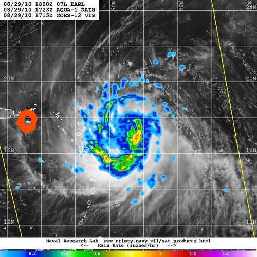
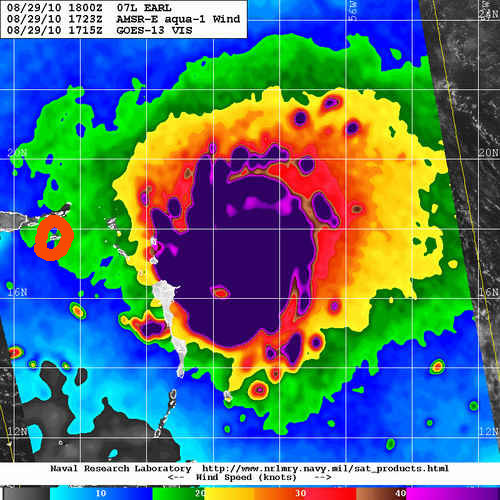
Here are two microwave images from the Aqua satellite near 1700 UTC on 29 August. To the left is the rainfall rate and to the right is the surface wind. The red circles on these images show the location of St. Croix.
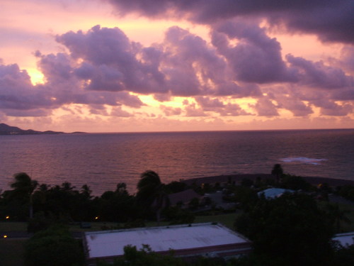
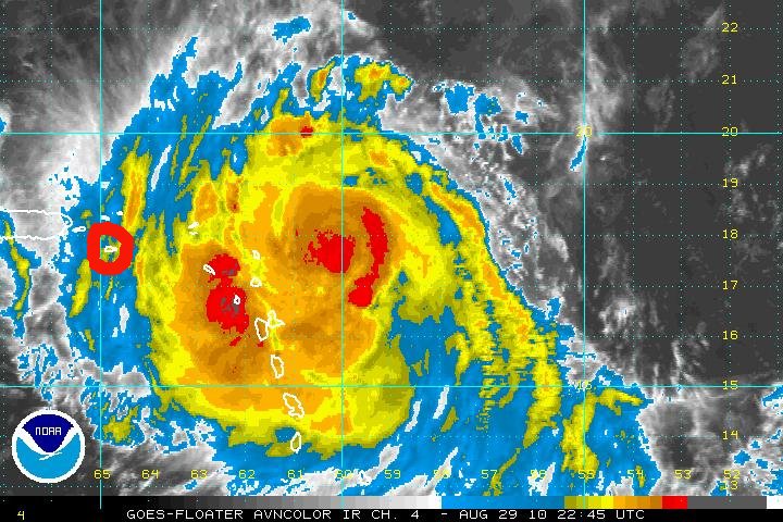
Here is a view around 1830 local time (2230 UTC, 29 August) of the sunset from Saska's terrace, which faces northwest. There was a brisk breeze (15-20 kts) from the northeast at the time. Shortly after, we started receiving sharp but short rainshowers. The infrared satellite picture was taken at 2245 UTC on 29 August, with the red circle indicating St. Croix. The eye is located straight east of us, and should pass to the north, as the storm is moving to the WNW. Clearly, we are in for some wind and rain.
I am up at 0400 local time (0800 UTC, 30 August) and I estimate the wind to be about 30 kt out of the NNE. The moon is visible through thin high overcast and there are isolated rainshowers passing through. I saw one flash of distant lightning. According to the National Hurricane Center, Earl is now a category 2 storm with 85 kt maximum winds, and is pretty much following their predicted scenario, which puts us on the "soft" southern side during closest approach.
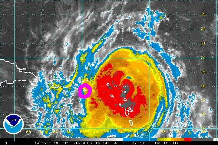
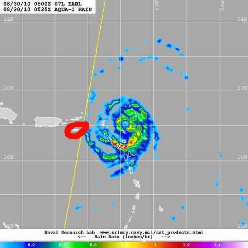
Below are an infrared image at 0715 UTC and a rainfall image at about 0530 UTC. Note the eye in the latter image.
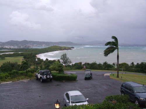
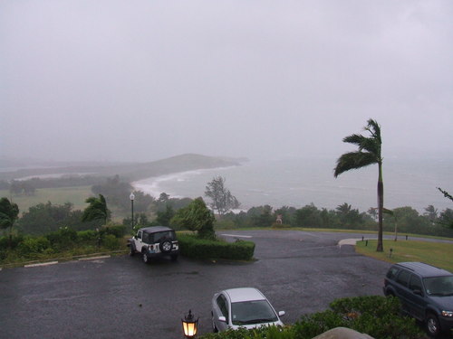
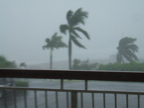
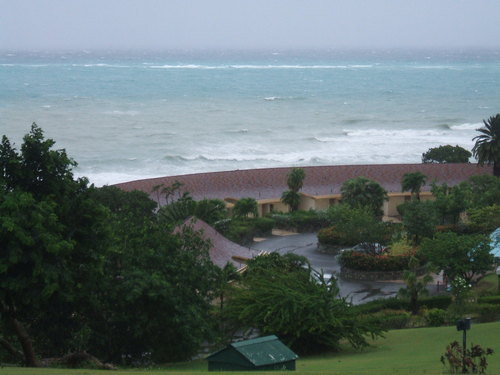
At first light on 30 August we are starting to get strong squalls with roughly 50 kt winds from the north. Compare the two views from the breakfast terrace. (We actually ate on the terrace in spite of squall winds -- the hurricane cloth did its job!) NHC is now calling Earl a category 3 storm with maximum winds of 95 knots. St. Croix is now under a hurricane warning.
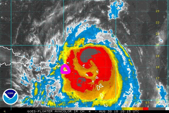
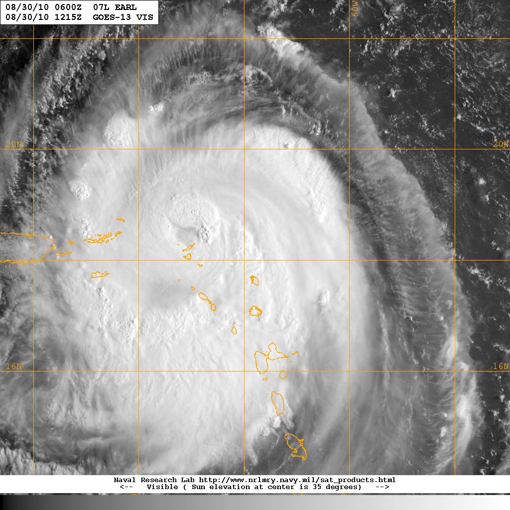
On the left is an infrared satellite picture at 1015 UTC (0615 local). Note that a principal rainband is just reaching St. Croix at that time, which explains the squalls. On the right is a visible image taken 2 hr later at 1215 UTC (0815 local, about when we were eating breakfast). See if you can find St. Croix!
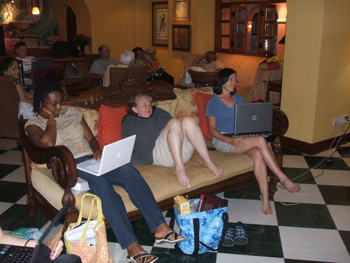
"You don't need a weatherman to tell which way the wind is blowing."
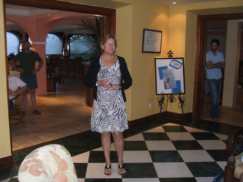
The hotel manager explaining why we can't go back to our rooms.
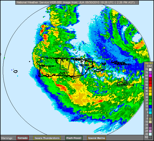
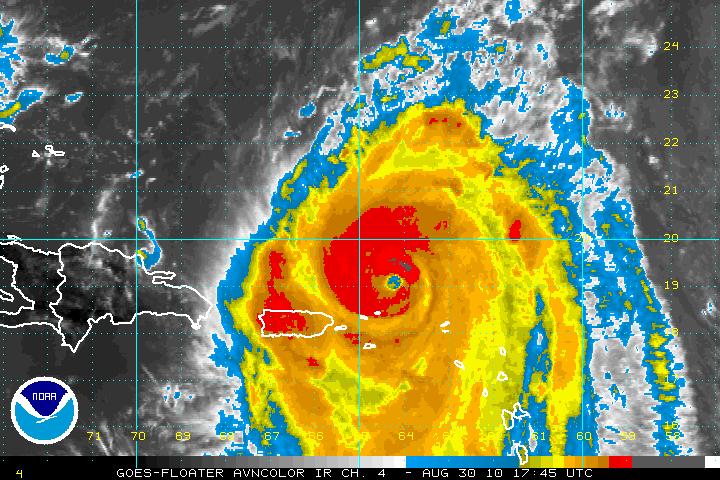
At 1800 UTC 30 August (1400 local) Earl is a category 3 storm with winds to 110 kts. Below are the reflectivity from the San Juan radar (1826 UTC) and the 1745 UTC infrared satellite picture. Note the eye in both views. St. Croix is on the inner edge of the main feeder band, so we are in for some rain and wind for a while.
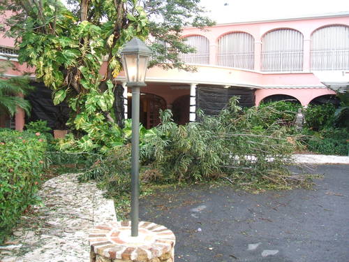
The morning after Earl the main damage is downed tree limbs, such as this one right at the Buccaneer Hotel entrance. The sky is bright with shallow cloud streets associated with a stiff southerly breeze feeding juicy air to Earl.
Adios a Earl, hola a Fiona!